Brownfield land
BLR16
| Field | Value | Fact links |
|---|---|---|
| Reference | BLR16 | Facts |
| Prefix | brownfield-land | Facts |
| Name | BLR16 | Facts |
| Dataset | Brownfield land | no fact link |
| Organisation | North Norfolk District Council | no fact link |
| Start date | 2019-12-09 | no fact link |
| End date | no fact link | |
| Entry date | 2019-12-09 | Facts |
| Typology | geography | no fact link |
| Point |
POINT (1.411064 52.719091)
|
Facts |
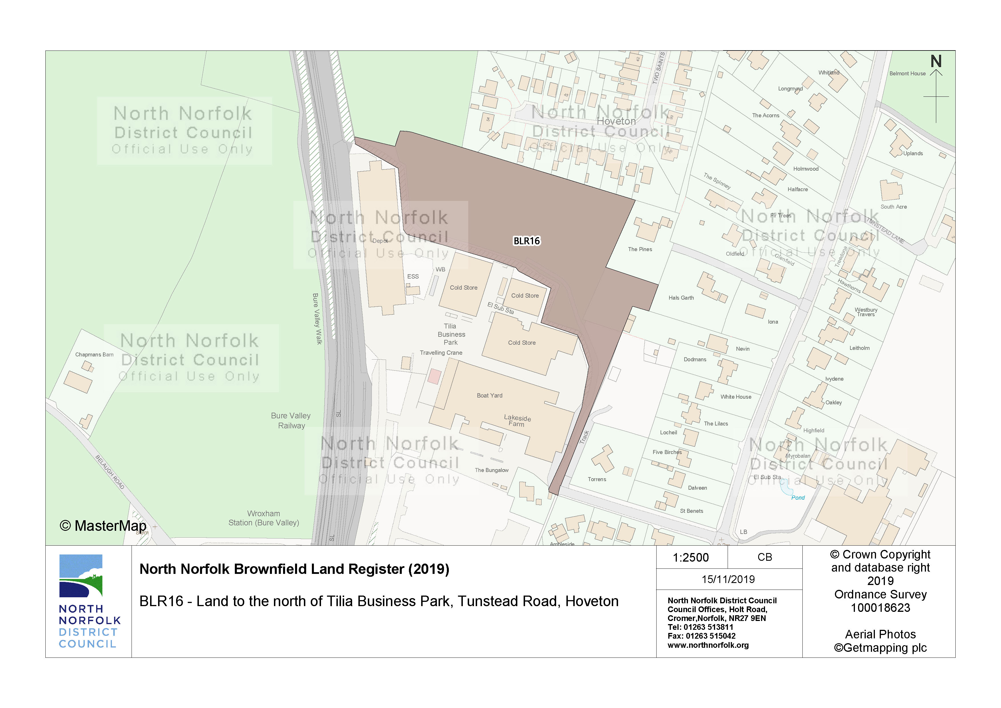
| Notes | The site is situated within an area designated for employment. Erection of 28 residential dwellings | Facts |
| Hectares | 1.68 | Facts |
| Deliverable | yes | Facts |
| Site address | Land to the north of Tilia Business Park Tunstead Road Hoveton | Facts |
| Site plan url | https://www.north-norfolk.gov.uk/media/3778/blr16.jpg | Facts |
| Ownership status | not-owned-by-a-public-authority | Facts |
| Maximum net dwellings | 28 | Facts |
| Planning permission date | 2018-10-17 | Facts |
| Planning permission type | outline-planning-permission | Facts |
| Planning permission status | permissioned | Facts |
| Planning permission history | https://idoxpa.north-norfolk.gov.uk/online-applications/applicationDetails.do?activeTab=summary&keyVal=_NNORF_DCAPR_85257 | Facts |
Available Code Snippets:
{
    "reference": "BLR16",
    "prefix": "brownfield-land",
    "name": "BLR16",
    "dataset": "brownfield-land",
    "organisation-entity": "235",
    "start-date": "2019-12-09",
    "end-date": "",
    "entry-date": "2019-12-09",
    "typology": "geography",
    "geometry": "",
    "point": "POINT (1.411064 52.719091)",
    "entity": 1721399,
    "notes": "The site is situated within an area designated for employment. Erection of 28 residential dwellings",
    "hectares": "1.68",
    "deliverable": "yes",
    "site-address": "Land to the north of Tilia Business Park Tunstead Road Hoveton",
    "site-plan-url": "https://www.north-norfolk.gov.uk/media/3778/blr16.jpg",
    "ownership-status": "not-owned-by-a-public-authority",
    "maximum-net-dwellings": "28",
    "planning-permission-date": "2018-10-17",
    "planning-permission-type": "outline-planning-permission",
    "planning-permission-status": "permissioned",
    "planning-permission-history": "https://idoxpa.north-norfolk.gov.uk/online-applications/applicationDetails.do?activeTab=summary&keyVal=_NNORF_DCAPR_85257"
}Loading...© Crown copyright and database right 2025
Licensed under the Open Government Licence v.3.0.
Geographical area
Help improve this data
Give feedback on this dataset, or email your questions and corrections to digitalland@communities.gov.uk.