Brownfield land
BLR14
| Field | Value | Fact links |
|---|---|---|
| CURIE | brownfield-land:BLR14 | no fact link |
| Prefix | brownfield-land | Facts |
| Reference | BLR14 | Facts |
| Name | BLR14 | Facts |
| Quality | Authoritative: We have some data from the authoritative source | no fact link |
| Dataset | Brownfield land | no fact link |
| Organisation | North Norfolk District Council | no fact link |
| Start date | 2019-12-09 | Facts |
| End date | Facts | |
| Entry date | 2019-12-09 | Facts |
| Typology | geography | no fact link |
| Point |
POINT (1.299163 52.930354)
|
Facts |
| Notes | Allocation Site | Facts |
| Hectares | 0.33 | Facts |
| Deliverable | yes | Facts |
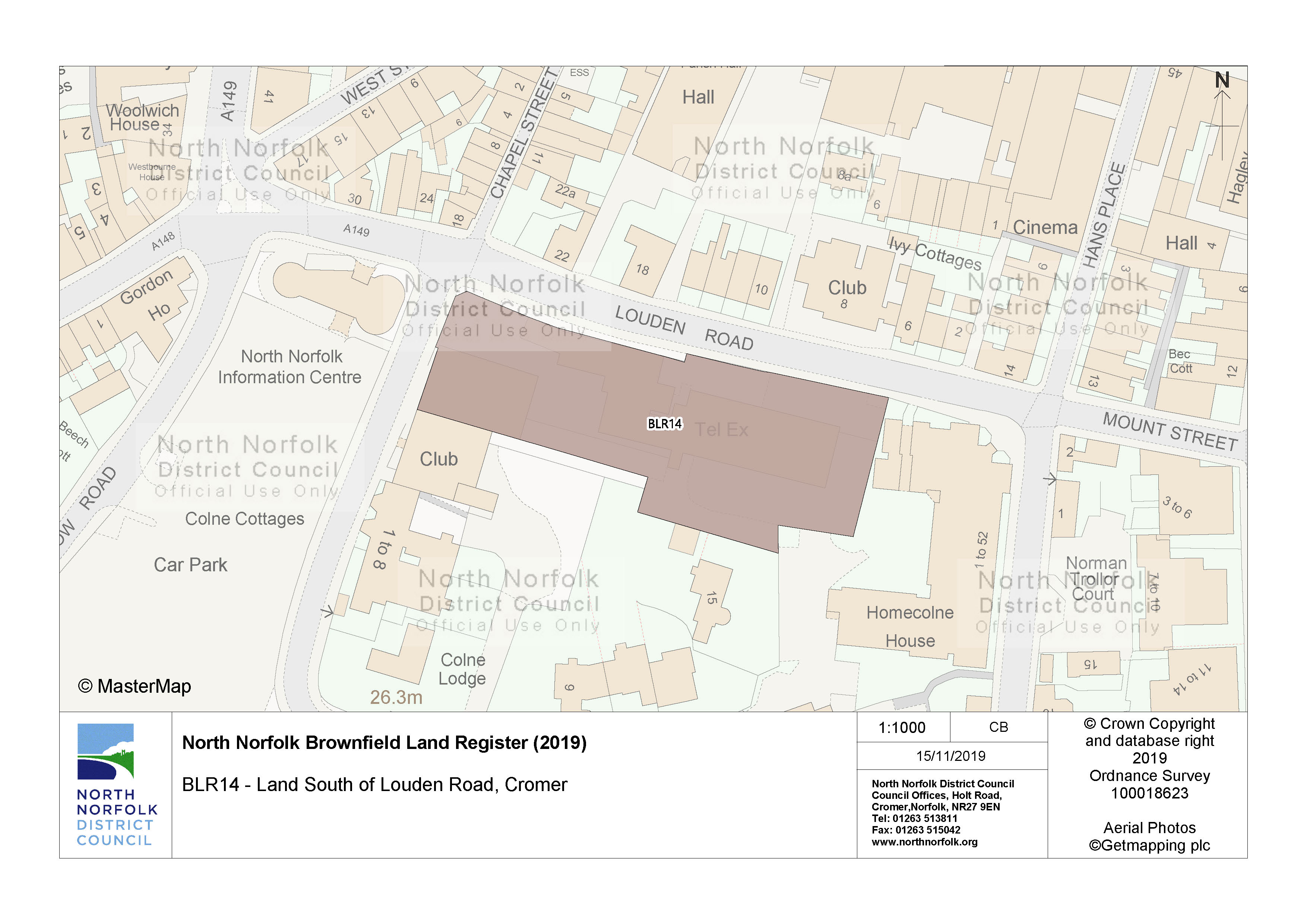
| Site address | Land South of Louden Road Cromer | Facts |
| Site plan url | https://www.north-norfolk.gov.uk/media/3778/blr14.jpg | Facts |
| Ownership status | not-owned-by-a-public-authority | Facts |
| Maximum net dwellings | 20 | Facts |
| Minimum net dwellings | 20 | Facts |
| Planning permission status | not-permissioned | Facts |
Available Code Snippets:
{
        "entry-date": "2019-12-09",
        "start-date": "2019-12-09",
        "end-date": "",
        "entity": 1721397,
        "name": "BLR14",
        "dataset": "brownfield-land",
        "typology": "geography",
        "reference": "BLR14",
        "prefix": "brownfield-land",
        "organisation-entity": "235",
        "geometry": "",
        "point": "POINT (1.299163 52.930354)",
        "quality": "authoritative",
        "notes": "Allocation Site",
        "hectares": "0.33",
        "deliverable": "yes",
        "site-address": "Land South of Louden Road Cromer",
        "site-plan-url": "https://www.north-norfolk.gov.uk/media/3778/blr14.jpg",
        "ownership-status": "not-owned-by-a-public-authority",
        "maximum-net-dwellings": "20",
        "minimum-net-dwellings": "20",
        "planning-permission-status": "not-permissioned"
}Loading...© Crown copyright and database right 2026
Licensed under the Open Government Licence v.3.0.
Geographical area
Help improve this data
Give feedback on this dataset, or email your questions and corrections to digitalland@communities.gov.uk.