Brownfield land
BLR09
| Field | Value | Fact links |
|---|---|---|
| Reference | BLR09 | Facts |
| Prefix | brownfield-land | Facts |
| Name | BLR09 | Facts |
| Dataset | Brownfield land | no fact link |
| Organisation | North Norfolk District Council | no fact link |
| Start date | 2018-10-08 | no fact link |
| End date | no fact link | |
| Entry date | 2019-12-09 | Facts |
| Typology | geography | no fact link |
| Point |
POINT (0.856495 52.953702)
|
Facts |
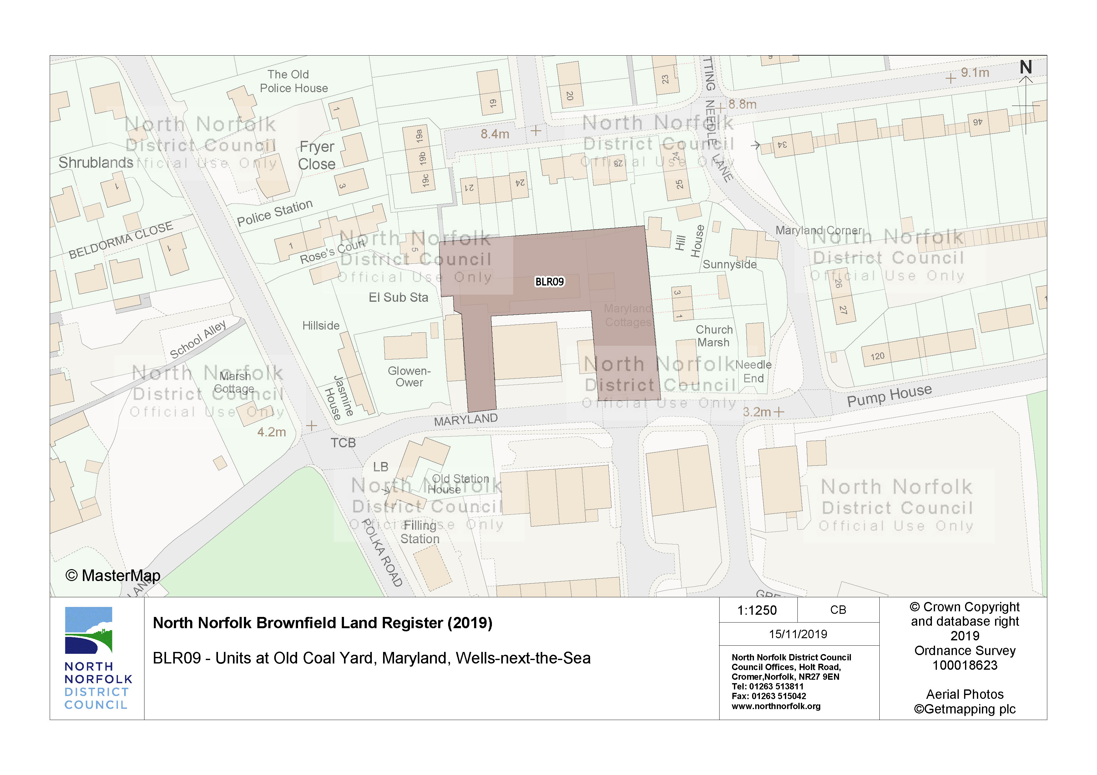
| Notes | Planning permission reference 17/1939. Demolition of existing grain store building and erection of dwellings, with associated car parking, access and erection of external steps to facilitate means of escape.. Erection of 9 dwellings comprising of a detached two storey dwelling, 3no. two storey terrace dwellings and 5no. three storey terrace dwelling. | Facts |
| Hectares | 0.28 | Facts |
| Deliverable | yes | Facts |
| Site address | Units at Old Coal Yard Maryland Wells-next-the-Sea | Facts |
| Site plan url | https://www.north-norfolk.gov.uk/media/3778/blr09.jpg | Facts |
| Ownership status | not-owned-by-a-public-authority | Facts |
| Maximum net dwellings | 9 | Facts |
| Planning permission date | 2018-08-16 | Facts |
| Planning permission type | full-planning-permission | Facts |
| Planning permission status | permissioned | Facts |
| Planning permission history | https://idoxpa.north-norfolk.gov.uk/online-applications/applicationDetails.do?activeTab=summary&keyVal=_NNORF_DCAPR_92308 | Facts |
Available Code Snippets:
{
    "reference": "BLR09",
    "prefix": "brownfield-land",
    "name": "BLR09",
    "dataset": "brownfield-land",
    "organisation-entity": "235",
    "start-date": "2018-10-08",
    "end-date": "",
    "entry-date": "2019-12-09",
    "typology": "geography",
    "geometry": "",
    "point": "POINT (0.856495 52.953702)",
    "entity": 1721393,
    "notes": "Planning permission reference 17/1939. Demolition of existing grain store building and erection of dwellings, with associated car parking, access and erection of external steps to facilitate means of escape.. Erection of 9 dwellings comprising of a detached two storey dwelling, 3no. two storey terrace dwellings and 5no. three storey terrace dwelling.",
    "hectares": "0.28",
    "deliverable": "yes",
    "site-address": "Units at Old Coal Yard Maryland Wells-next-the-Sea",
    "site-plan-url": "https://www.north-norfolk.gov.uk/media/3778/blr09.jpg",
    "ownership-status": "not-owned-by-a-public-authority",
    "maximum-net-dwellings": "9",
    "planning-permission-date": "2018-08-16",
    "planning-permission-type": "full-planning-permission",
    "planning-permission-status": "permissioned",
    "planning-permission-history": "https://idoxpa.north-norfolk.gov.uk/online-applications/applicationDetails.do?activeTab=summary&keyVal=_NNORF_DCAPR_92308"
}Loading...© Crown copyright and database right 2025
Licensed under the Open Government Licence v.3.0.
Geographical area
Help improve this data
Give feedback on this dataset, or email your questions and corrections to digitalland@communities.gov.uk.