Brownfield land
BLR2302
| Field | Value | Fact links |
|---|---|---|
| Reference | BLR2302 | Facts |
| Prefix | brownfield-land | Facts |
| Name | BLR2302 | Facts |
| Dataset | Brownfield land | no fact link |
| Organisation | East Cambridgeshire District Council | no fact link |
| Start date | 2017-12-12 | no fact link |
| End date | no fact link | |
| Entry date | 2019-12-12 | Facts |
| Typology | geography | no fact link |
| Point |
POINT (0.339699 52.332447)
|
Facts |
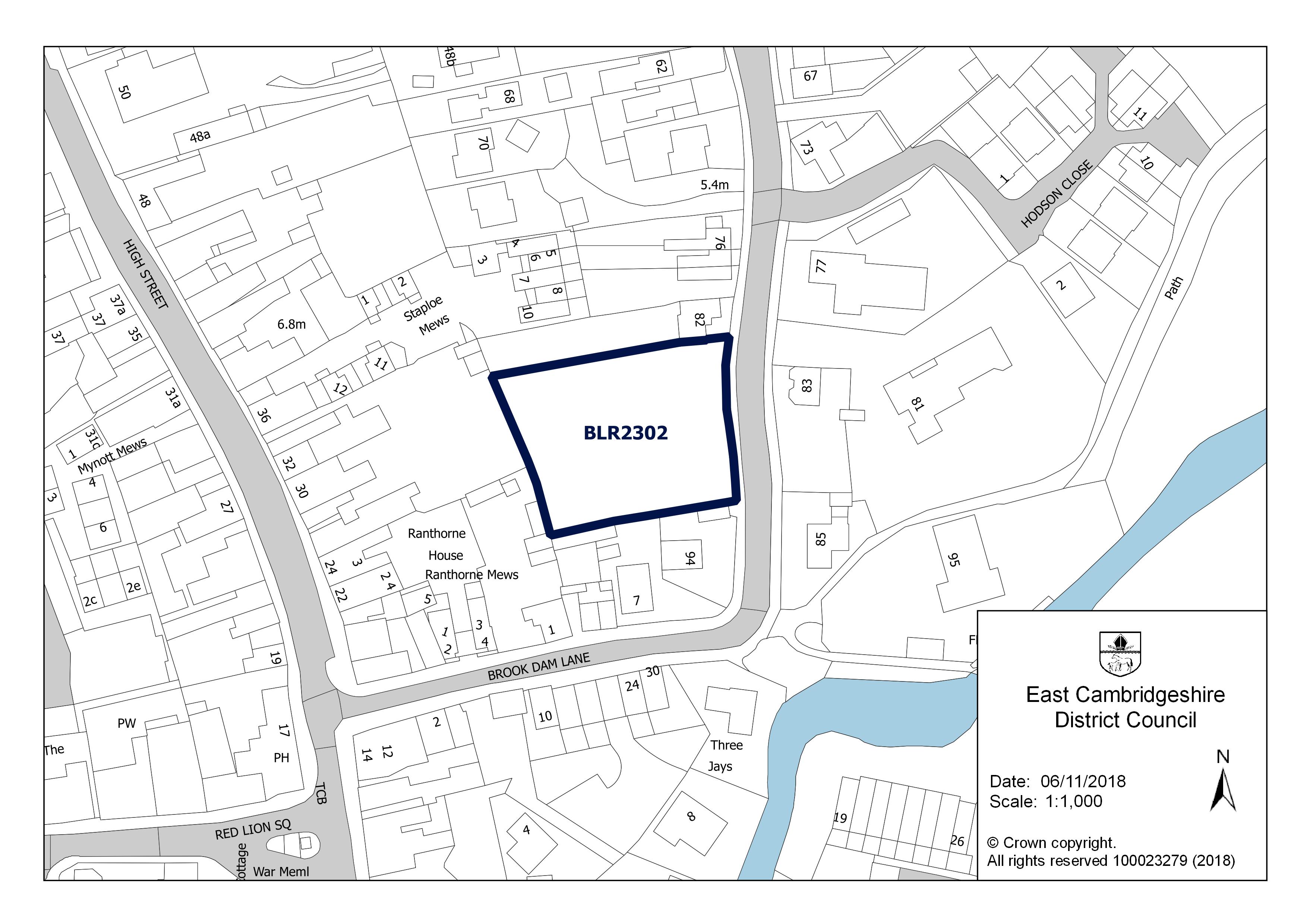
| Notes | Erection of 10 dwellings following the demolition of 90 Paddock Street. Creation of new vehicular access. Alterations and extensions to front boundary wall. | Facts |
| Hectares | 0.18 | Facts |
| Deliverable | yes | Facts |
| Site address | 90 Paddock Street Soham Ely Cambridgeshire CB7 5JA | Facts |
| Site plan url | https://eastcambs.gov.uk/sites/default/files/2024-12/BLR2302.jpg | Facts |
| Ownership status | not-owned-by-a-public-authority | Facts |
| Maximum net dwellings | 0 | Facts |
| Minimum net dwellings | 9 | Facts |
| Planning permission date | 2017-11-15 | Facts |
| Planning permission type | full-planning-permission | Facts |
| Planning permission status | permissioned | Facts |
| Planning permission history | http://pa.eastcambs.gov.uk/online-applications/applicationDetails.do?activeTab=summary&keyVal=OSCSVVGG0CS00 | Facts |
Available Code Snippets:
{
    "reference": "BLR2302",
    "prefix": "brownfield-land",
    "name": "BLR2302",
    "dataset": "brownfield-land",
    "organisation-entity": "118",
    "start-date": "2017-12-12",
    "end-date": "",
    "entry-date": "2019-12-12",
    "typology": "geography",
    "geometry": "",
    "point": "POINT (0.339699 52.332447)",
    "entity": 1712422,
    "notes": "Erection of 10 dwellings following the demolition of 90 Paddock Street. Creation of new vehicular access. Alterations and extensions to front boundary wall.",
    "hectares": "0.18",
    "deliverable": "yes",
    "site-address": "90 Paddock Street Soham Ely Cambridgeshire CB7 5JA",
    "site-plan-url": "https://eastcambs.gov.uk/sites/default/files/2024-12/BLR2302.jpg",
    "ownership-status": "not-owned-by-a-public-authority",
    "maximum-net-dwellings": "0",
    "minimum-net-dwellings": "9",
    "planning-permission-date": "2017-11-15",
    "planning-permission-type": "full-planning-permission",
    "planning-permission-status": "permissioned",
    "planning-permission-history": "http://pa.eastcambs.gov.uk/online-applications/applicationDetails.do?activeTab=summary&keyVal=OSCSVVGG0CS00"
}Loading...© Crown copyright and database right 2025
Licensed under the Open Government Licence v.3.0.
Geographical area
Help improve this data
Give feedback on this dataset, or email your questions and corrections to digitalland@communities.gov.uk.