Brownfield land
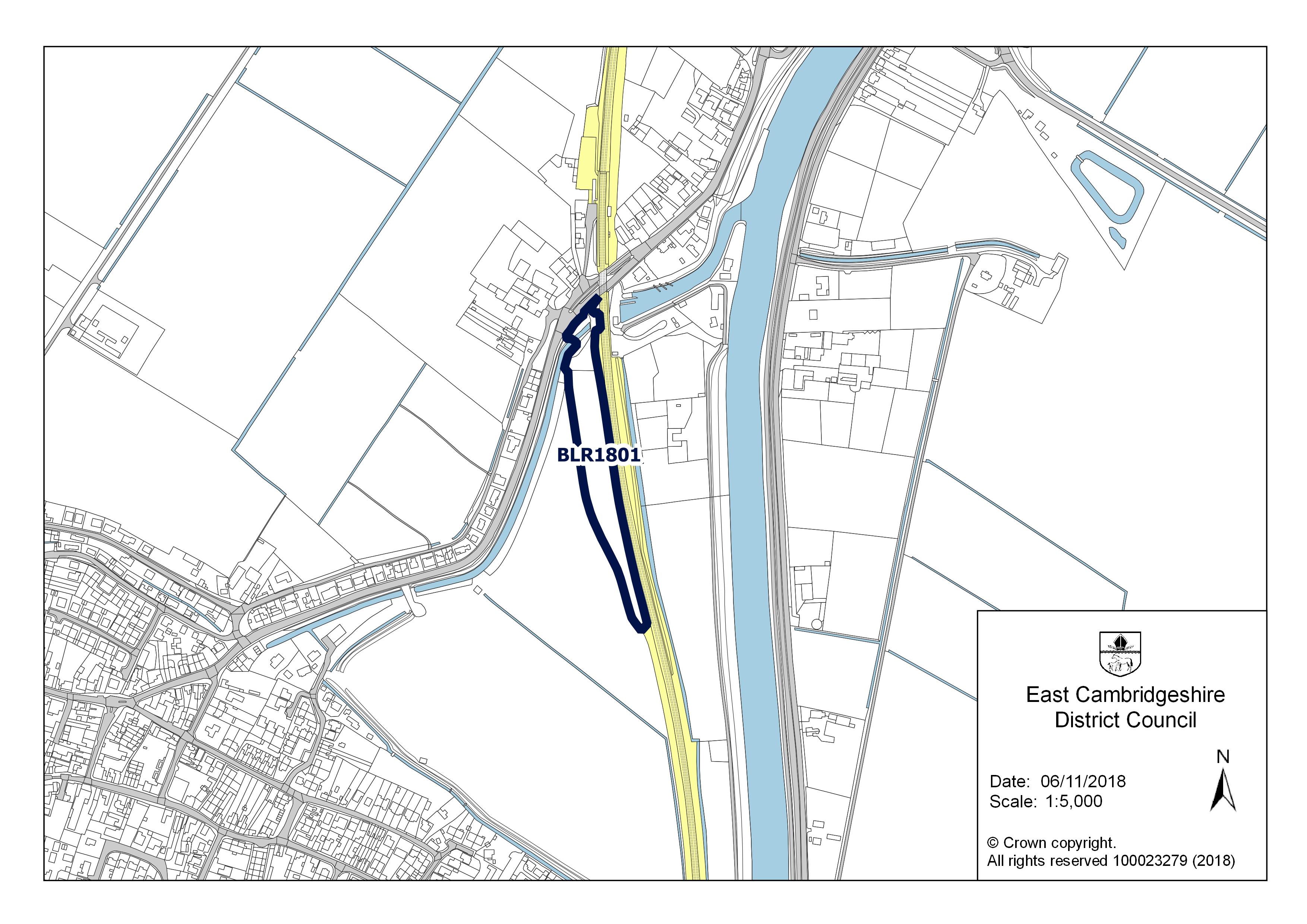
BLR1801
| Field | Value | Fact links |
|---|---|---|
| Reference | BLR1801 | Facts |
| Prefix | brownfield-land | Facts |
| Name | BLR1801 | Facts |
| Dataset | Brownfield land | no fact link |
| Organisation | East Cambridgeshire District Council | no fact link |
| Start date | 2022-12-12 | no fact link |
| End date | no fact link | |
| Entry date | 2022-12-12 | Facts |
| Typology | geography | no fact link |
| Point |
POINT (0.316207 52.45979)
|
Facts |
| Notes | Residential development incorporating a new access, strategic landscaping & public open space. | Facts |
| Hectares | 1.07 | Facts |
| Deliverable | yes | Facts |
| Site address | Station Road Littleport Ely CB6 1JL | Facts |
| Site plan url | https://eastcambs.gov.uk/sites/default/files/2024-12/BLR1801.jpg | Facts |
| Ownership status | not-owned-by-a-public-authority | Facts |
| Maximum net dwellings | 0 | Facts |
| Minimum net dwellings | 39 | Facts |
| Planning permission date | 2020-03-20 | Facts |
| Planning permission type | outline-planning-permission | Facts |
| Planning permission status | permissioned | Facts |
| Planning permission history | http://pa.eastcambs.gov.uk/online-applications/applicationDetails.do?activeTab=summary&keyVal=MZCLJJGG07G00 | Facts |
Available Code Snippets:
{
    "reference": "BLR1801",
    "prefix": "brownfield-land",
    "name": "BLR1801",
    "dataset": "brownfield-land",
    "organisation-entity": "118",
    "start-date": "2022-12-12",
    "end-date": "",
    "entry-date": "2022-12-12",
    "typology": "geography",
    "geometry": "",
    "point": "POINT (0.316207 52.45979)",
    "entity": 1712417,
    "notes": "Residential development incorporating a new access, strategic landscaping & public open space.",
    "hectares": "1.07",
    "deliverable": "yes",
    "site-address": "Station Road Littleport Ely CB6 1JL",
    "site-plan-url": "https://eastcambs.gov.uk/sites/default/files/2024-12/BLR1801.jpg",
    "ownership-status": "not-owned-by-a-public-authority",
    "maximum-net-dwellings": "0",
    "minimum-net-dwellings": "39",
    "planning-permission-date": "2020-03-20",
    "planning-permission-type": "outline-planning-permission",
    "planning-permission-status": "permissioned",
    "planning-permission-history": "http://pa.eastcambs.gov.uk/online-applications/applicationDetails.do?activeTab=summary&keyVal=MZCLJJGG07G00"
}Loading...© Crown copyright and database right 2025
Licensed under the Open Government Licence v.3.0.
Geographical area
Help improve this data
Give feedback on this dataset, or email your questions and corrections to digitalland@communities.gov.uk.