Brownfield land
BLR1701
| Field | Value | Fact links |
|---|---|---|
| Reference | BLR1701 | Facts |
| Prefix | brownfield-land | Facts |
| Name | BLR1701 | Facts |
| Dataset | Brownfield land | no fact link |
| Organisation | East Cambridgeshire District Council | no fact link |
| Start date | 2017-12-12 | no fact link |
| End date | no fact link | |
| Entry date | 2019-12-12 | Facts |
| Typology | geography | no fact link |
| Point |
POINT (0.25157 52.359882)
|
Facts |
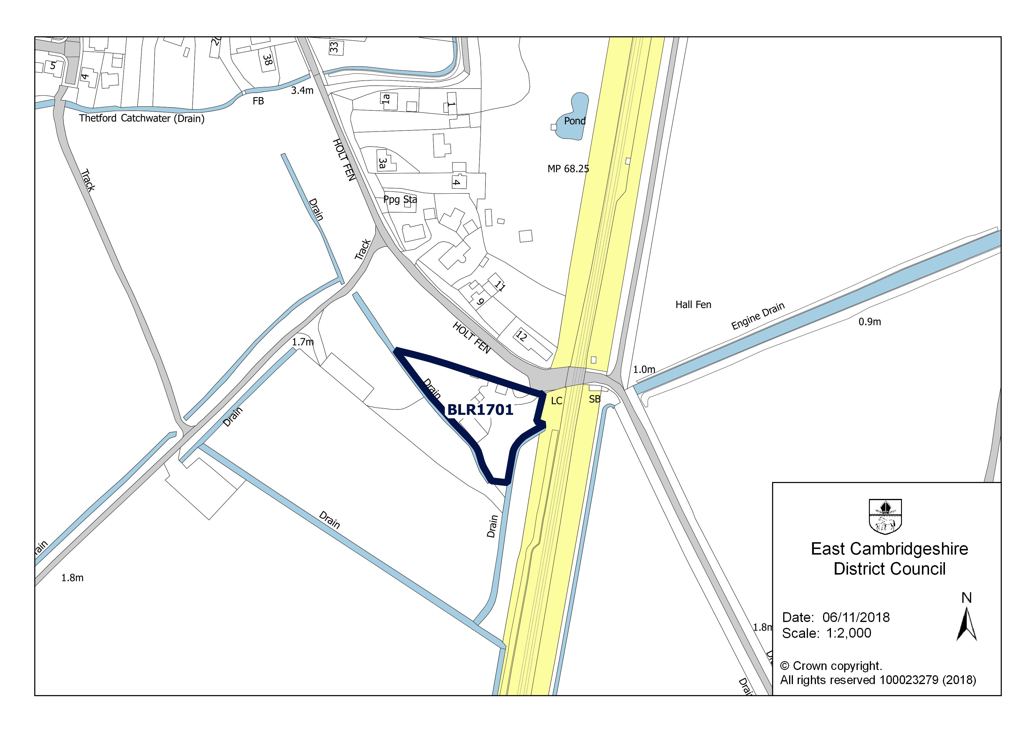
| Notes | Erection of four dwellings and associated works | Facts |
| Hectares | 0.26 | Facts |
| Deliverable | yes | Facts |
| Site address | Land Adacent 12 Holt Fen Little Thetford Cambridgeshire CB6 3BH | Facts |
| Site plan url | https://eastcambs.gov.uk/sites/default/files/2024-12/BLR1701.jpg | Facts |
| Ownership status | not-owned-by-a-public-authority | Facts |
| Maximum net dwellings | 4 | Facts |
| Minimum net dwellings | 4 | Facts |
| Planning permission date | 2016-04-15 | Facts |
| Planning permission type | outline-planning-permission | Facts |
| Planning permission status | permissioned | Facts |
| Planning permission history | https://pa.eastcambs.gov.uk/online-applications/applicationDetails.do?activeTab=documents&keyVal=NYFC8TGGGTW00 | Facts |
Available Code Snippets:
{
    "reference": "BLR1701",
    "prefix": "brownfield-land",
    "name": "BLR1701",
    "dataset": "brownfield-land",
    "organisation-entity": "118",
    "start-date": "2017-12-12",
    "end-date": "",
    "entry-date": "2019-12-12",
    "typology": "geography",
    "geometry": "",
    "point": "POINT (0.25157 52.359882)",
    "entity": 1712416,
    "notes": "Erection of four dwellings and associated works",
    "hectares": "0.26",
    "deliverable": "yes",
    "site-address": "Land Adacent 12 Holt Fen Little Thetford Cambridgeshire CB6 3BH",
    "site-plan-url": "https://eastcambs.gov.uk/sites/default/files/2024-12/BLR1701.jpg",
    "ownership-status": "not-owned-by-a-public-authority",
    "maximum-net-dwellings": "4",
    "minimum-net-dwellings": "4",
    "planning-permission-date": "2016-04-15",
    "planning-permission-type": "outline-planning-permission",
    "planning-permission-status": "permissioned",
    "planning-permission-history": "https://pa.eastcambs.gov.uk/online-applications/applicationDetails.do?activeTab=documents&keyVal=NYFC8TGGGTW00"
}Loading...© Crown copyright and database right 2025
Licensed under the Open Government Licence v.3.0.
Geographical area
Help improve this data
Give feedback on this dataset, or email your questions and corrections to digitalland@communities.gov.uk.