Brownfield land
BLR1003
Geographical area
About this entity
| Fact links | ||
|---|---|---|
| CURIE | brownfield-land:BLR1003 | no fact link |
| Prefix | brownfield-land | Facts about Prefix |
| Reference | BLR1003 | Facts about Reference |
| Name | BLR1003 | Facts about Name |
| Quality | Authoritative: We have some data from the authoritative source | no fact link |
| Dataset | Brownfield land | no fact link |
| Organisation | East Cambridgeshire District Council | no fact link |
| Start date | 2017-12-12 | Facts about Start date |
| End date | Facts about End date | |
| Entry date | 2019-12-12 | Facts about Entry date |
| Typology | geography | no fact link |
| Point |
POINT (0.26369 52.400856)
|
Facts about Point |
| Notes | The site is allocated by the Local Plan for mixed-use development. Allocated for a retail-led scheme (4,200sqm max), with retail and/or office as complimentary uses. | Facts about Notes |
| Hectares | 0.61 | Facts about Hectares |
| Deliverable | yes | Facts about Deliverable |
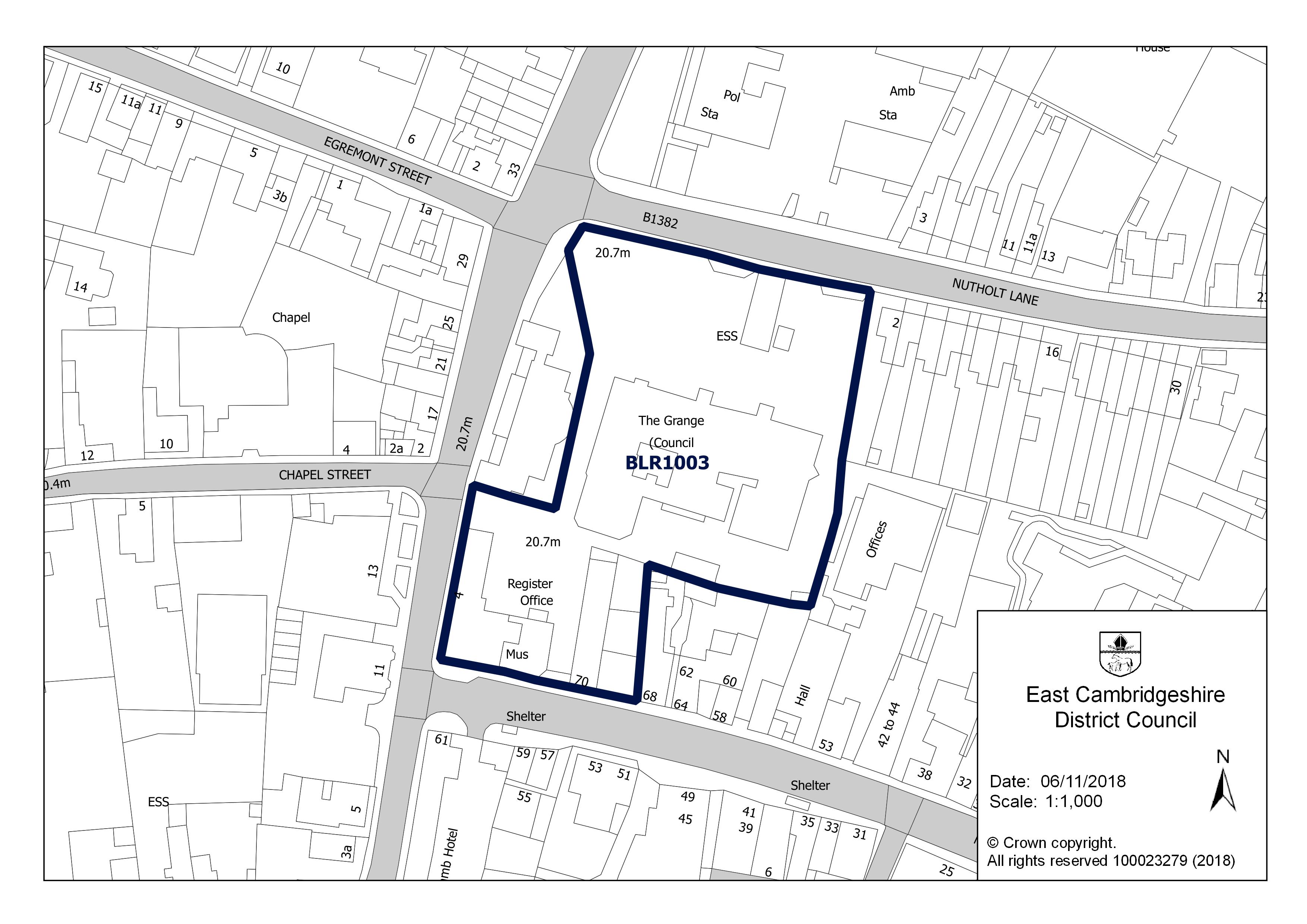
| Site address | The Grange, Nutholt Lane, Ely CB7 4EE | Facts about Site address |
| Site plan url | https://eastcambs.gov.uk/sites/default/files/2024-12/BLR1003.jpg | Facts about Site plan url |
| Ownership status | owned-by-a-public-authority | Facts about Ownership status |
| Maximum net dwellings | 10 | Facts about Maximum net dwellings |
| Minimum net dwellings | 10 | Facts about Minimum net dwellings |
| Planning permission status | not-permissioned | Facts about Planning permission status |
Available Code Snippets:
{
        "entry-date": "2019-12-12",
        "start-date": "2017-12-12",
        "end-date": "",
        "entity": 1712407,
        "name": "BLR1003",
        "dataset": "brownfield-land",
        "typology": "geography",
        "reference": "BLR1003",
        "prefix": "brownfield-land",
        "organisation-entity": 118,
        "geometry": "",
        "point": "POINT (0.26369 52.400856)",
        "quality": "authoritative",
        "notes": "The site is allocated by the Local Plan for mixed-use development. Allocated for a retail-led scheme (4,200sqm max), with retail and/or office as complimentary uses.",
        "hectares": "0.61",
        "deliverable": "yes",
        "site-address": "The Grange, Nutholt Lane, Ely CB7 4EE",
        "site-plan-url": "https://eastcambs.gov.uk/sites/default/files/2024-12/BLR1003.jpg",
        "ownership-status": "owned-by-a-public-authority",
        "maximum-net-dwellings": "10",
        "minimum-net-dwellings": "10",
        "planning-permission-status": "not-permissioned"
}Loading...© Crown copyright and database right 2026
Licensed under the Open Government Licence v.3.0.
Help improve this data
Give feedback on this dataset, or email your questions and corrections to digitalland@communities.gov.uk.