Brownfield land
BLR01
| Field | Value | Fact links |
|---|---|---|
| Reference | BLR01 | Facts |
| Prefix | brownfield-land | Facts |
| Name | BLR01 | Facts |
| Dataset | Brownfield land | no fact link |
| Organisation | North Norfolk District Council | no fact link |
| Start date | 2017-12-18 | no fact link |
| End date | no fact link | |
| Entry date | 2019-12-09 | Facts |
| Typology | geography | no fact link |
| Point |
POINT (1.286255 52.932845)
|
Facts |
| Notes | The calculation used for net minimum (and net dwelling range from) is 60% of the site area multiplied by minimum indicative density (North Norfolk Core Strategy Policy HO7) (in this case 40 dwellings per hectare). The calculation used for net dwelling range to is 70% of the site area multiplied by the same minimum indicative density. | Facts |
| Hectares | 1.03 | Facts |
| Deliverable | yes | Facts |
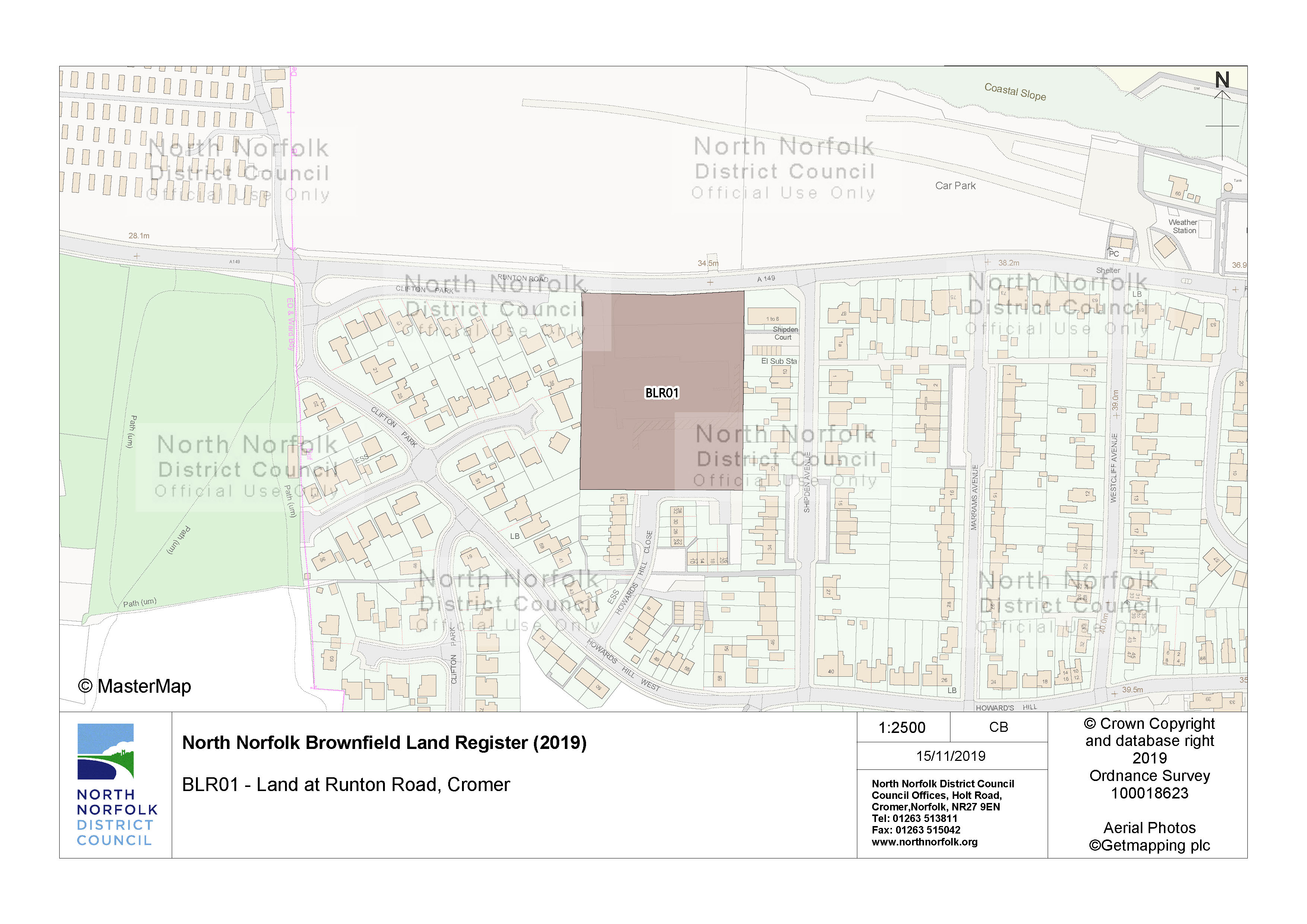
| Site address | Land at Runton Road Cromer | Facts |
| Site plan url | https://www.north-norfolk.gov.uk/media/3778/blr01.jpg | Facts |
| Ownership status | not-owned-by-a-public-authority | Facts |
| Maximum net dwellings | 29 | Facts |
| Minimum net dwellings | 25 | Facts |
| Planning permission date | 2006-06-26 | Facts |
| Planning permission type | outline-planning-permission | Facts |
| Planning permission status | permissioned | Facts |
Available Code Snippets:
{
    "reference": "BLR01",
    "prefix": "brownfield-land",
    "name": "BLR01",
    "dataset": "brownfield-land",
    "organisation-entity": "235",
    "start-date": "2017-12-18",
    "end-date": "",
    "entry-date": "2019-12-09",
    "typology": "geography",
    "geometry": "",
    "point": "POINT (1.286255 52.932845)",
    "entity": 1705765,
    "notes": "The calculation used for net minimum (and net dwelling range from) is 60% of the site area multiplied by minimum indicative density (North Norfolk Core Strategy Policy HO7) (in this case 40 dwellings per hectare). The calculation used for net dwelling range to is 70% of the site area multiplied by the same minimum indicative density.",
    "hectares": "1.03",
    "deliverable": "yes",
    "site-address": "Land at Runton Road Cromer",
    "site-plan-url": "https://www.north-norfolk.gov.uk/media/3778/blr01.jpg",
    "ownership-status": "not-owned-by-a-public-authority",
    "maximum-net-dwellings": "29",
    "minimum-net-dwellings": "25",
    "planning-permission-date": "2006-06-26",
    "planning-permission-type": "outline-planning-permission",
    "planning-permission-status": "permissioned"
}Loading...© Crown copyright and database right 2025
Licensed under the Open Government Licence v.3.0.
Geographical area
Help improve this data
Give feedback on this dataset, or email your questions and corrections to digitalland@communities.gov.uk.