Brownfield land
BLR1101
| Field | Value | Fact links |
|---|---|---|
| Reference | BLR1101 | Facts |
| Prefix | brownfield-land | Facts |
| Name | BLR1101 | Facts |
| Dataset | Brownfield land | no fact link |
| Organisation | East Cambridgeshire District Council | no fact link |
| Start date | 2021-12-12 | no fact link |
| End date | no fact link | |
| Entry date | 2021-12-12 | Facts |
| Typology | geography | no fact link |
| Point |
POINT (0.38102 52.30873)
|
Facts |
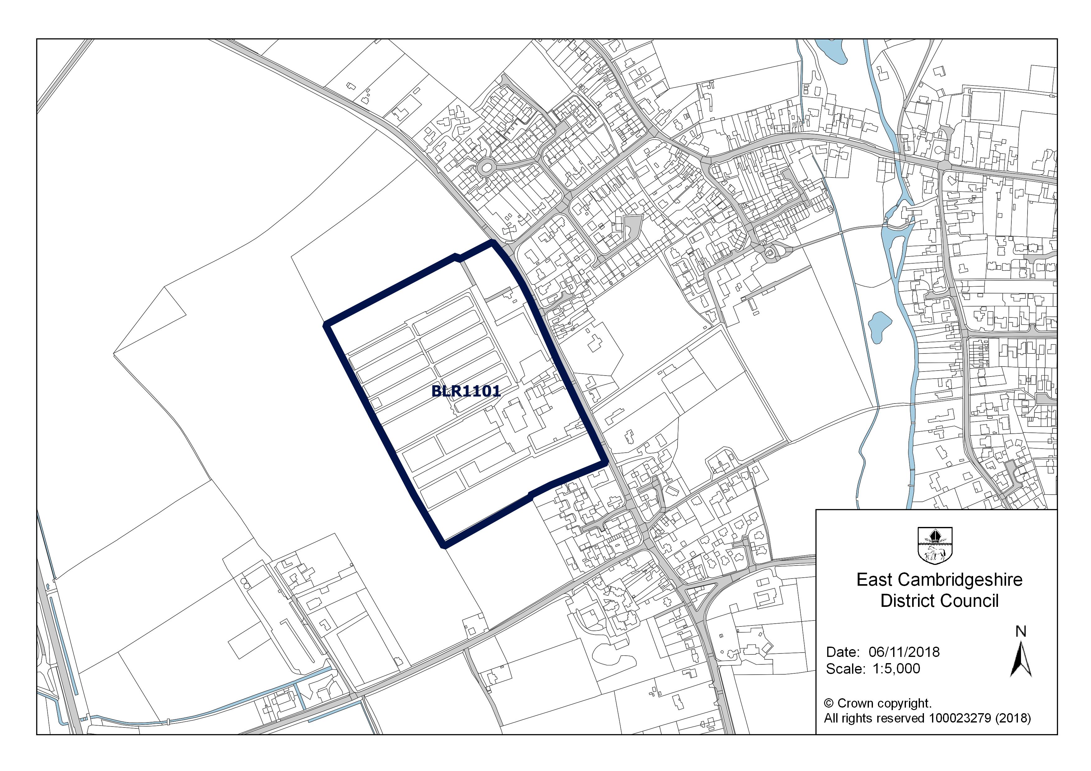
| Notes | 150 residential dwellings, a 75-bed care home, a local shop and an ancillary medical consultation facility. Outline planning application includes 75-bed care home, shop and medical facility. | Facts |
| Hectares | 8.66 | Facts |
| Deliverable | yes | Facts |
| Site address | Scotsdale Garden Centre, Market Street, Fordham, CB7 5LQ | Facts |
| Site plan url | https://eastcambs.gov.uk/sites/default/files/2024-12/BLR1101.jpg | Facts |
| Ownership status | not-owned-by-a-public-authority | Facts |
| Maximum net dwellings | 0 | Facts |
| Minimum net dwellings | 150 | Facts |
| Planning permission date | 2018-08-08 | Facts |
| Planning permission type | outline-planning-permission | Facts |
| Planning permission status | permissioned | Facts |
| Planning permission history | https://pa.eastcambs.gov.uk/online-applications/applicationDetails.do?activeTab=documents&keyVal=OQGBMOGG0CI00 | Facts |
Available Code Snippets:
{
    "reference": "BLR1101",
    "prefix": "brownfield-land",
    "name": "BLR1101",
    "dataset": "brownfield-land",
    "organisation-entity": "118",
    "start-date": "2021-12-12",
    "end-date": "",
    "entry-date": "2021-12-12",
    "typology": "geography",
    "geometry": "",
    "point": "POINT (0.38102 52.30873)",
    "entity": 1712414,
    "notes": "150 residential dwellings, a 75-bed care home, a local shop and an ancillary medical consultation facility. Outline planning application includes 75-bed care home, shop and medical facility.",
    "hectares": "8.66",
    "deliverable": "yes",
    "site-address": "Scotsdale Garden Centre, Market Street, Fordham, CB7 5LQ",
    "site-plan-url": "https://eastcambs.gov.uk/sites/default/files/2024-12/BLR1101.jpg",
    "ownership-status": "not-owned-by-a-public-authority",
    "maximum-net-dwellings": "0",
    "minimum-net-dwellings": "150",
    "planning-permission-date": "2018-08-08",
    "planning-permission-type": "outline-planning-permission",
    "planning-permission-status": "permissioned",
    "planning-permission-history": "https://pa.eastcambs.gov.uk/online-applications/applicationDetails.do?activeTab=documents&keyVal=OQGBMOGG0CI00"
}Loading...© Crown copyright and database right 2025
Licensed under the Open Government Licence v.3.0.
Geographical area
Help improve this data
Give feedback on this dataset, or email your questions and corrections to digitalland@communities.gov.uk.